>
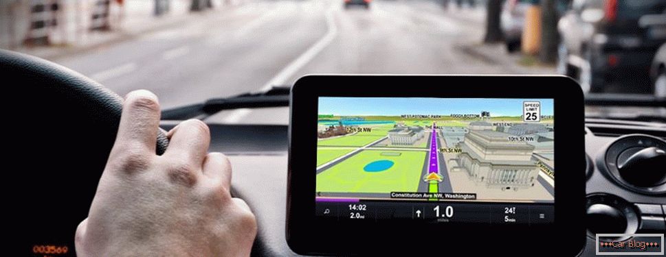
Many car owners can no longer imagine how you can drive without a navigator, although 10 or 15 years ago these little helpers were an expensive wonder with not very impressive functionality.

The use of navigators by drivers of heavy trucks makes it much easier to drive to unfamiliar places
For drivers of heavy vehicles, the movement of which in most cases involves travel through unfamiliar territory, the use of navigators is all the more justified given the fact that there are an order of magnitude more traffic restrictions for traffic, and in terms of tonnage and dimensions.
The best navigation systems for freight vehicles allow to take into account precisely these parameters, although here it is necessary to speak not so much about the hardware itself, as about the symbiosis of the hardware and software parts.
What should be able to standard car navigator:
- pave the optimal route of movement, taking into account the state of the highway;
- be able to search for an object on the map by its address and / or name;
- indicate the exact location of the vehicle;
- warn of traffic jams and congestion;
- report potential hazards;
- have a voice control function that allows you to control the device without being distracted from the road;
- assist in difficult sections of the road, tangled interchanges.
If one-system navigator is enough for trips around the city, then for moving over long distances it is better to choose devices that allow downloading several programs.
Criteria for choosing GPS for trucks
The modern market of GPS navigators is so huge that for an inexperienced driver, the choice of a suitable device becomes a real problem. What should be considered before buying this compact and indispensable in a long journey device?
Consider the main criteria to which you should pay particular attention when choosing the best navigator for trucks:
- The size of the monitor. The principle “the more the better” is not quite appropriate here. The size, of course, matters, but the trucker needs a compromise: the screen must be large enough to distinguish small details on the map, but the device should not severely limit the view. The best option is a device with a diagonal size of 5 to 8 inches. Here, of course, one should also be guided by the geometry of the vehicle cabin, since in many models the navigator can be mounted around the center console, and then the screen size can be chosen arbitrarily large.
- The screen resolution is another important parameter: the larger it is, the clearer the image will be and the font will be clearer, and the driver will be able to see more small details. Practice shows that 480 x 272 pixels for a 5-inch device is an acceptable parameter. Less is undesirable, more is impractical (we are not going to watch movies on the navigator - there are other gadgets for that).
- The functionality of a GPS navigator for a truck, in terms of utility for driving, does not matter in principle. Of course, the presence of a Bluetooth connection, a connector for connecting to a parking camera device, an FM transmitter or a TV tuner can be useful additions to the main functionality of the navigator, but everything depends on the state of your finances - you can afford a more expensive device - well, no - also not deadly. For example, Bluetooth allows you to use the navigator to synchronize with a cell phone as a hand-free headset, but an absolute majority of smartphones have the same functionality. The FM transmitter allows you to “liven up” the navigation device, displaying its prompts on the existing audio system, but this is usually not urgently needed, as in the TV tuner.
- The amount of RAM depends on how much and what programs can be used on the gadget. As a rule, 128 megabytes is enough for most modern applications. Equally important is the amount of internal memory, which stores all the programs and maps, which can be up to a dozen, as well as various multimedia data. Here the principle is simple - the more the better. 2 GB is a necessary minimum, but current standards are much higher and start at 16 gigabytes.
- Most often, the OS for Android is on the navigators for truckers, but in principle, this parameter, like the version of the operating system, is not particularly important, since you will have to work mainly within the navigation program. Of course, the software used must be backward compatible, so it’s still better to rely on the latest generation of gadgets - you definitely will not have problems with them when using most software and maps.
- The same principle applies to the choice of the version of the navigation program - the higher it is, the better, although almost all popular software can be updated via the Internet, and with maps it is enough to get into the free Wi-Fi distribution zone.
- Navigation software features are one of the most relevant criteria when choosing a navigator. In Russia and neighboring countries, navigation software from NAVITEL is the most popular. This is a fairly user-friendly, functional and fully Russified program, for which updates regularly appear, including cartographic data. If we talk about the quality of the maps, they are quite detailed; here you can not only see the house numbers, but also distinguish the quality of the roads. In NAVITEL there are settings options for trucks. However, the functionality of the majority of such programs, including the one under consideration, for truckers moving on domestic roads, will still not be enough - there is no information about roads with restrictions for freight transport. Unfortunately, it does not depend on the choice of a particular device or navigation program. Europe is another matter: for the Old World, detailed cartographic data concerning the peculiarities of the movement of heavy vehicles has been available for a long time. It remains to wait for them to be integrated for domestic roads.
But even without this GPS navigator is an indispensable device for a truck. With it, you can quickly lay a route of any length and measure its duration, choose the best path, find a specific building (for example, a hotel or motel) in an unfamiliar city. Most of the cards show gas stations, service stations and parking lots for heavy and heavy vehicles, allowing you to save tracks for future trips and make your own notes on the map, which serve as a guide or reminder of something. Moreover, all this information can be used both individually and collectively.
Regarding the choice of the best navigator for trucks between GPS and GLONASS, the latter does not have any advantages over the more common GPS. The quality of the cards is more or less comparable, however, the cost of GLONASS navigators is usually higher, and the range of such devices is still low.
What does truck drivers offer a modern market for navigation devices? We offer you the ranking of the best navigators for trucks of 2018:
Garmin Nuvi 465T
Garmin can be uniquely ranked as a leader in the manufacture of navigation systems. And it would be strange if she did not take care of long-distance drivers, who in the United States and Europe belong to the privileged class. Navigator Garmin Nuvi 465T - one of these developments, intended for use on commercial vehicles.
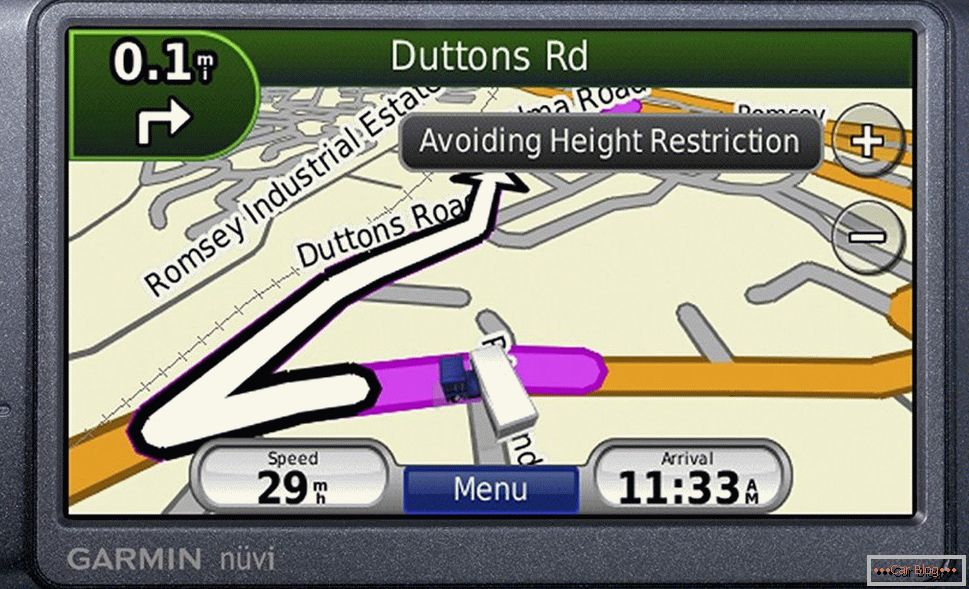
Leader in the manufacture of navigation systems
This is one of the few devices that allows data to be entered into the memory of a truck — its dimensions and weight, the class of cargo being carried and other indicators that will be taken into account when analyzing cartographic data. Just in case, we repeat that this feature will not work in Russia, although it would be very useful for our roads.
A distinctive feature of this device is the ability to create multiple user profiles, each of which will be tied to a specific truck. This makes the Nuvi 465T a versatile device suitable for use by companies with a large fleet of trucks.
Navigator is not equipped with the largest screen (4.3 inches diagonally), but this disadvantage is compensated by the presence of the touch panel and a good monitor resolution.
The interface of the Nuvi 465T is very simple and intuitive, the initial menu offers two options for work: view the map or specify the destination of the route. In the latter case, the gadget will inform the driver about approaching the junction, warning in advance which way to turn. If you select the appropriate option, it will even call the streets past which you are passing (or other attractions marked on the map). This model is equipped with the “Lane Assist” function, which helps to choose the right lane when approaching interchanges requiring staying in a certain lane, from which the turn in the right direction is allowed.
The navigator is delivered with European City Navigator NT maps, which contain very detailed information regarding all possible restrictions for a specific part of the route. The GPU navigator provides a smooth, but fairly fast scrolling of the map. It is possible to download new maps of a compatible format.
The Garmin Nuvi 465T offers truck-oriented routing functions that take into account restrictions related to the parameters of a truck (its dimensions, weight, type of cargo being transported). If you are a truck driver, roads will be excluded from the route, where there are corresponding weight restrictions. If the height of your vehicle is large enough, you are unlikely to get into a situation where you have to look for a bypass road due to the fact that the tunnel or cable / wire networks will be too low. Finally, this gadget allows you to specify several targets, and the program will calculate the optimal route, including the locations of the proposed stops.
If on the way dangerous areas (critical narrowing of the road, descents / ascents with a very large gradient, strong gusts of side wind, areas that are being repaired or there are traffic jams, etc.), you will be informed of this.
In addition to navigation capabilities, the Nuvi 465T has other features:
- choice of universal time;
- viewing graphics in a common JPG format;
- currency converter;
- calculator;
- unit converter;
- LockTM function to protect the navigator from theft.
TomTom Trucker 6000
The TomTom Trucker 6000 device is included in the ranking of the best navigators for trucks not by accident: the Dutch company specializing in the manufacture of navigation systems is quite popular in Europe, and this device is designed specifically for use in trucks.
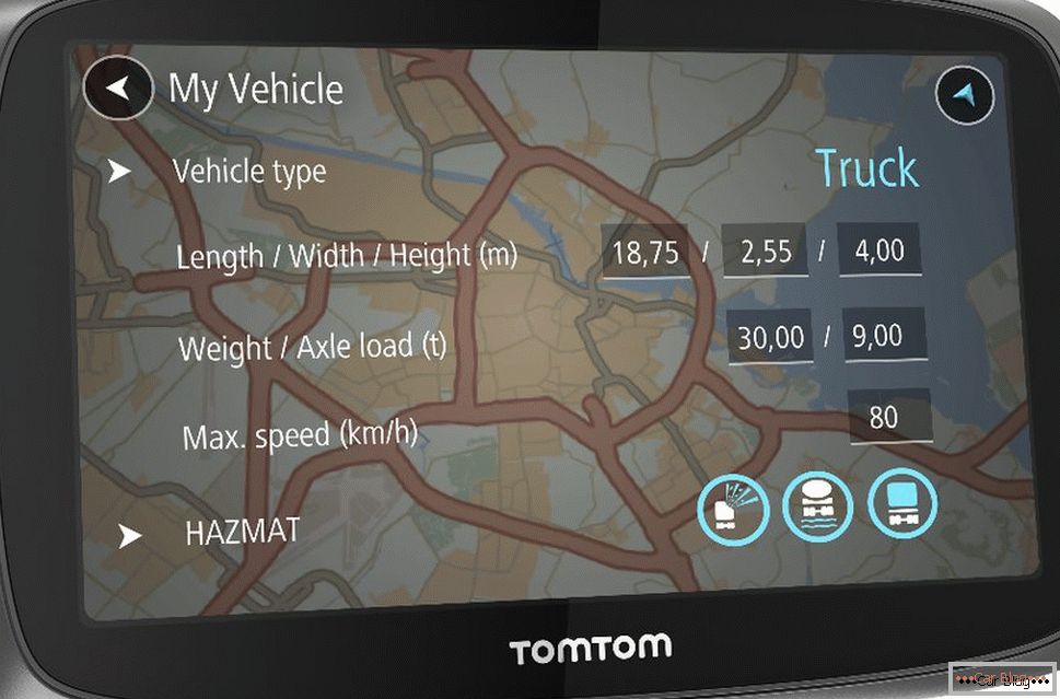
One of the best truck navigators
Trucker 6000, like the device from Garmin, is able to make special routes for trucks, taking into account the characteristics of the vehicle: the type of truck, its dimensions, the type and weight of the transported cargo, as well as the speed limits of the vehicle.
With this gadget, the trucker can determine the time spent on the road and arriving at the destination with acceptable accuracy. For this purpose, the proprietary function TomTom Traffic, which is able to assess the current traffic situation, is intended. Visually assess the distance traveled will be shown by the progress bar at the bottom of the navigator of the route, it also shows traffic jams and traffic jams, as well as installed traffic cameras.
When you buy a TomTom Trucker 6000, you get 25 Lifetime Truck Maps for freight transport at your disposal. As the name implies, they are provided free of charge with the possibility of lifelong updates (currently updates are released every four years). Of course, we are talking exclusively about European highways. Chances for the inclusion of information about Russian roads are not great.
Среди других «фишек» навигатора можно отметить наличие функции Advance Lane Guidance, помогающей водителю заранее перестроиться на нужную полосу в зависимости от дорожных условий, а также функции Speak&Go, предоставляющей возможность голосового управления устройством.
Стоит отметить, что экран Trucker 6000 в полтора больше, чем у конкурента от Гармин – 6 дюймов по диагонали, а наличие сенсорной панели делает возможным управление навигатором в интерактивном режиме. Крепится гаджет с помощью магнитной системы Click&Go.
PTV Loxane TNP4 / TNP7
The company PTV Loxane (France) also has in its arsenal navigation systems focused on the use of trucks. We are talking about devices TNP4 and TNP7, the main difference between them lies in the size of the screen: the first model is 4 inches, the second, respectively, 7 inches. Which of these navigators is better for trucks - the driver must decide. If the small screen suits him perfectly - why pay more, because a 7-inch device costs 100 euros more.
 Discounts for new cars! Profitable loan from 9.9% installments 0%
  adom.ru Навигатор PTV Loxane TNP4 / TNP7 родом из Франции
But on the other hand, it has a touch panel, in addition to this, this model can be controlled using the poison of the function keys located on the front side of the panel.
Вместе с самими устройствами поставляется фирменное ПО Truck Navigator Map&Guide, которое оптимизировано под грузовой транспорт. Имеется опция ввода характеристик конкретного транспортного средства (вес, габариты, тип перевозимого груза), в соответствии с которыми строится оптимальный маршрут, учитывающий существующие дорожные ограничения (мосты, тоннели, эстакады, места пересечения дорог с высотными коммуникациями и т. д.).
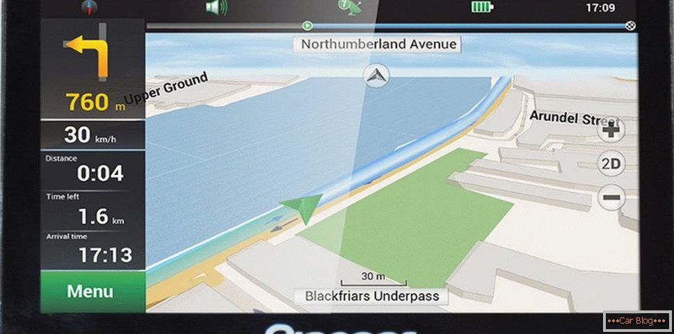
Maps can be viewed both in the usual, "flat" form, and in the three-dimensional (three-dimensional) projection. Additional functionality of French navigators includes a Bluetooth module that allows using PTV Loxane as a device for making hands-free calls.
Следует отметить, что программный модуль Map&Guide Truck Navigator продаётся отдельно, причём его стоимость достаточно велика (350 евро при цене 650 евро за TNP7), а за сборник европейских карт придётся выложить ещё 100 евро. То есть полный комплект обойдётся в тысячу евро – немного дороговато для продукта, который у конкурентов стоит намного дешевле при примерно одинаковых возможностях.
Pioneer PI-730
The Japanese company specializing in the production of automotive electronics, has in its arsenal and navigators. Pioneer PI-730 is a model focused on freight transport and equipped with proprietary iGO Primo software. With it, you can easily pave the desired route of transportation, taking into account the characteristics of the vehicle (number of axles, width, height, weight). The accuracy of the maps used is also not satisfactory, in any case, European cartographic data will allow you to avoid roads where truck movement is limited.
Navigator Pioneer PI-730 - focused on freight transport
The voice alert function of problem areas will help you make the right decisions on time without having to visually inspect the display of the device. There is a function of 3D-visualization, through which you can easily identify objects along the way.
In addition to direct navigation capabilities, the Pioneer PI-730 offers users quite extensive additional functionality.
If you are looking for which navigator to buy for your truck based on Microsoft Windows CE, then this device is the best option. With it, you will be able to use applications oriented to the most widespread operating system in the world, and this is a very extensive range of multimedia programs. The presence of FM-transmitter allows you to integrate the navigator with built-in speaker system.
The display uses a seven-inch resistor touchscreen with a resolution of 800 x 480 pixels (just 15 years ago, the best displays for desktop PCs could not boast of such a resolution). The remaining parameters of the navigator are no less impressive:
- 800 MHz CPU;
- OP 128 MB;
- built-in memory 8 GB;
- possibility of expanding memory with 32 GB microSD cards (the bundle includes an 8-gigabyte card)
- the ability to update maps via the Internet;
- routes can be saved and make notes on them;
- built-in MP3 and video player;
- currency converter;
- world clock;
- calculator.
If the features or functionality of iGO Primo do not suit you, you can always install other navigation software: NavLux, City Guide, Truck Nextgen, Libelle. The device is completed with a holder, a cord for recharging from the onboard network, a USB cable for integration with a laptop or desktop computer.
As we see, truckers have a lot to choose from, and we don’t pretend to the fullness of our rating: there are at least a dozen other devices oriented to the use in freight transport, and this list is constantly updated. We chose those navigators that are most popular with Russian truck drivers. The final choice is yours!

